This paper outlines the technical differences between Beidou and GPS from nine aspects. By reading this article, you can help you to understand the technical principles of the Beidou system. include:
Tri-frequency signal;
Active positioning and passive positioning;
Short message communication service;
Domestic monitoring;
Step by step;
Local strengthening and gradual maturity;
positioning accuracy;
Promote the upgrading of the entire manufacturing industry;
The construction speed is fast.
The construction of Beidou satellite is an important part of China's strategic undertaking. Of course, national defense security is the most important reason for building Beidou. In the battlefield where geographic information is so important, you must have your own intellectual property rights and products. Although the civilian use of GPS is free in China, if the United States shuts down or uses its "SA policy" to "make hands and feet" on GPS in the wartime, it is undoubtedly fatal for countries that rely on GPS.
The Beidou satellite started in 1992 and achieved regional coverage in 2012. It can serve Asian countries and has now gone abroad and is welcomed by Southeast Asian countries. This paper aims to carefully compare the difference between Beidou and GPS from a technical point of view.
The Beidou uses a tri-band signal, and the GPS uses a dual-frequency signal, which is the advantage of the Beidou. Although GPS launched the first tri-band satellite from May 28, 2010, it was several years after the GPS satellites were all aged and discarded. These years are the advantages of Beidou. The tri-band signal can better eliminate the influence of high-order ionospheric delay, improve the positioning reliability, enhance the data pre-processing capability, and greatly improve the fixed efficiency of the ambiguity. Moreover, if there is a problem with one frequency signal, the conventional method can be used to locate the other two frequencies, which improves the reliability and anti-interference ability of the positioning. Beidou is the world's first satellite navigation system to provide tri-band signal services.
2 Active positioning and passive positioningActive positioning means that the receiver itself needs to transmit information and satellite communication, and passive positioning is not required. The active positioning of the Beidou generation, active positioning technology as long as two satellites can complete the positioning, but the information center DEM (Digital Elevation Model) database is required to support and participate in the solution. It was retained in the second generation of the Beidou, but not as the main positioning method. The second generation of Beidou uses passive positioning, which is the same as GPS. It does not require the information center to participate in the solution, and active positioning is used as a supplementary function.
The advantage of this function is that when the quality of the satellites you observe is very poor and the number is small (in theory, passive positioning requires at least 4 satellites to solve XYZ and time four unknown parameters, actually need more), still can Positioning. This feature is useful for emergencies. For example, in a valley, the observation conditions are very poor, and it is important to know the approximate location. The downside is that you will reveal your location in the war.
The information center needs to participate in the solution because "the resources are limited". For example, a Beidou generation handheld can be located once every 60 seconds, and cannot be frequently located to ensure that the information center cannot be overloaded. However, the main reason why the Beidou generation cannot be used for civilian use is not because This one.
The Beidou generation is called the Beidou Satellite Experiment System (RDSS), and the Beidou II is called the Beidou Satellite Navigation System (RNSS). The “first generation, second generation†is for convenience. From the name, we can know that the Beidou generation is just an internal experiment. It is tested whether our theory and technology are feasible, how accurate the positioning is, and then the subsequent improvement. The original intention of the design is not intended for civilian use.
3 short message communication serviceThis is an original feature of Chinese satellite navigation and is very practical. At the time of the Wenchuan earthquake in 2008, the only communication method in the earthquake zone was the Beidou generation. This feature is not unexpectedly preserved in the second generation. However, this function is also limited in capacity, so it is not suitable for daily communication functions, but is suitable as an emergency communication. Based on this feature, Beidou also has the advantage of not only knowing where I am, but also letting others know where you are. This feature is good for help.
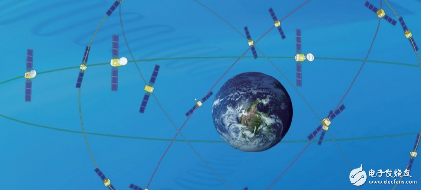
4 Domestic monitoringA satellite positioning system generally consists of three parts: a spatial constellation part, a ground monitoring part, and a user receiver part. Among them, the ground ground monitoring part is composed of three parts: monitoring station, main control station and injection station.
The GPS system has five monitoring stations, one master station and three injection stations around the world to ensure satellite operation. These stations are located in the United States and are evenly distributed around the world. These include the American mainland of the American continent, Guam and Hawaii in the Pacific Ocean, Diego and Western Asia in the Indian Ocean, and the Ascension Islands in the Atlantic Ocean. China can't build a monitoring station to the whole world, so China must consider when designing the Beidou system. The ground monitoring part is only built in China, which can guarantee the normal operation of the whole system. It is not impossible to build a station outside the country, but even if it is built, it only plays a role in improving the accuracy, and it cannot be used as a control function. This was originally a disadvantage of Beidou. Domestic surveillance was forced out. There were no other options, but now it is the security advantage of Beidou and it is not subject to other countries.
The first Arctic remote sensing satellite data receiving station “Arctic Station†outside China will start construction in Sweden this year and is expected to be completed in two years. China will build its first overseas satellite tracking station in Argentina in South America. From South America to the Arctic, China's satellite industry has opened up its globalization model.
5 step by stepGPS must be used after the entire system is built. At present, Beidou's 14 in-orbit satellites use five geostationary orbit (GEO) satellites, five tilted geosynchronous orbit (IGSO) satellites, and four medium-high circular orbit (MEO) satellites. The Beidou constellation program was hard-won. Xu Academician said that there were several programs involved in the competition. The revision of the program lasted for three years. The final plan was not to say that there were no shortcomings, but it was definitely the most Good one. Closer to home, the Beidou satellite navigation system, with the support of this innovative space constellation, launched only 16 satellites and officially opened in the Asia-Pacific region on December 27, 2012. This will help speed up the commercial process of Beidou, help to further improve the subsequent systems, and help accelerate the maturity of the Beidou industrial chain. After all, the biggest market for Beidou is definitely China. Let the Beidou system develop in the Asia-Pacific region for a few years, let the chip mature for a few years, and it will be relatively easy to promote it to the world. Moreover, satellite utilization efficiency in the Asia-Pacific region is certainly higher, and it is worthy of priority investment.
6 local strengthening, gradually matureIn theory, the positioning accuracy of GPS in the world is quite comparable. The Beidou system has been particularly strengthened for China and its surrounding areas, and the geometric conditions of domestic satellites are better. The accuracy of single-point positioning depends on two aspects: one is the observation accuracy, and the other is the spatial geometric distribution of the observed satellite. In the navigation, the precision attenuation factor DOP is used to represent the contribution of satellite space graphics, including: spatial precision attenuation factor GDOP, position accuracy attenuation factor PDOP, time precision attenuation factor TDOP, plane precision attenuation factor HDOP, vertical precision attenuation factor VDOP, relative positioning geometry Precision attenuation factor RDOP. With the maturity of the Beidou global system, the DOP is getting smaller and smaller, and its positioning accuracy in China and surrounding areas exceeds GPS is only a matter of time. "Step-by-step maturity" is not an excuse, but a technological and theoretical advancement.
(1) The number of satellites has increased.
The GPS design uses 21+3 satellites, namely 21 working satellites and 3 spare satellites. At present, GPS has actually used 32 satellites. The more satellites, the more redundant data will be obtained, the more reliable the data, and the smaller the DOP value. There are only 16 Beidou now. When the number of Beidou satellites is increasing, more observation data will be obtained, and the accuracy is inevitable. At present, Beidou chips generally support GPS. There may be the following reasons. The first is to supplement the accuracy of the Beidou system, and the second is to open up the market (only the Beidou is used at the beginning). In this case, the chip is more complicated, the power consumption is higher, and the development is more difficult. But it can't be said that it is all bad. At present, compatible with different systems is also the trend of industry development. GLONASS chips are generally compatible with GPS, and Beidou chips also support GLONASS or even three systems. Compatible systems, more data redundancy, higher precision, and a small DOP. This feature will also become an advantage for Chinese chip manufacturers.
To add, the current Meizu MX4, MX4pro, Xiaomi 4, Huawei G7, Samsung S5, NOTE4 now support GPS, GLONASS, Beidou. It can be seen that compatibility with the three major navigation systems is already the trend of the times. I believe that in the near future, there will be more and more terminals compatible with Beidou.
(2) Correct model optimization.
The errors associated with the signal propagation path are: tropospheric refractive error, ionospheric refractive error delay error, multipath effect, and Earth's rotation effect error. These errors can't be completely eliminated, and they can only be reduced. The Klobuchar model for improving the ionospheric refractive error delay error is based on long-term meteorological observations to construct an empirical formula for the ionospheric refraction over time. To put it bluntly, it is guessed, but there is a level, there is data support, and a clever guess, only after the test is carried out, it is easy to use, and it will continue to be changed if it is not easy to use. The ionospheric troposphere is different in different parts of the world. These formulas are constructed based on foreign observation data. It will naturally be worse in China. We need to give Beidou more time to accumulate observation data, waiting for development or optimization. Suitable for correcting models in China.
(3) The accuracy of satellite orbit is improved.
The actual orbit of the satellite must be a certain gap from the design track. The principle of pseudorange positioning is to determine the three-dimensional coordinates of the receiver antenna by the method of resection. Only the accuracy of the satellite orbit improves the positioning accuracy. The orbit of the satellite is fitted by the observation data of the monitoring station. The longer the observation time, the more accumulated data and the more accurate the fitted orbit. Beidou lacks foreign observation data, so the orbital accuracy is higher in the Asia-Pacific region, and the accuracy of the orbit in foreign countries will be poor. To make up for this defect, you also need to give Beidou time. Let me mention the geostationary orbit (GEO) satellite. The GEO satellite can't do a complete rest with respect to the Earth, and there will be some drift. There is only one geosynchronous orbit, and the resources are very scarce. The international track divides this orbit into a small segment and a small arc. The satellite can only move within the allocated range. Otherwise, it may collide with other satellites. It is necessary to adjust the position of the GEO satellite. At present, the Beidou is adjusted to use a pulse type. The position of the satellite can only be adjusted according to the whole number of times. It cannot be zero a few times, so there may be more than one shortage and one less shortage. In the subsequent launch of the GEO satellite, the satellite will be changed to a continuous type, and the number of sprays will be increased to enhance the satellite control capability and accuracy. Once the adjustment is made, the previous observations are obsolete and the data needs to be re-accumulated. During the satellite adjustment, the satellite was in a state of failure because we did not know its specific location and it took several days to re-orbit. Fortunately, the number of GEO satellites is relatively small (5), and the orbit determination is easier than the other two satellites, and the speed is faster. This is not the case with the other two satellites. The observation time is long and the accuracy of the fitted orbit is naturally increased until it is exhausted.
7 Positioning accuracyThe positioning accuracy of the Beidou system is 25m and the elevation is 30m, which is increased to the current level of 10m and the elevation is 10m. The accuracy of the speed measurement is from 0.4m per second to 0.2m, and the time accuracy is better than 20ns. Currently, the Beidou system service in China and surrounding areas. Performance is comparable to GPS. Academician Xu said that their measured accuracy (calculated according to the medium error) can reach the level of accuracy of 4-5m and elevation of 5-6m. Academician Xu said that Beidou could achieve such precision when it was just put into use. Even when they designed the Beidou system, they did not expect it. They were very satisfied, and Beidou still had a lot of room for improvement, and the precision could be further improved.
The accuracy of the above 10m, many people think should be the average accuracy of the Asia-Pacific region. It should be noted that the plane accuracy and elevation accuracy of Beidou are basically the same, and the horizontal accuracy of the GPS system is really good, but its elevation accuracy is soft ribs, which is much worse than the horizontal accuracy, generally 1.5 times to 2 times.
GPS positioning accuracy can reach mm level, which can be achieved, but can not be separated from the restrictions. There are many forms of satellite positioning methods. If the status of the user's satellite measuring equipment is in operation, it can be divided into static positioning and dynamic positioning. If the position of the reference point is different, it can be divided into absolute positioning and relative positioning. The differential technique is based on the principle of synchronous homology. The base station using known points is used to calculate the correction information and then send it to the rover to correct the instantaneous position of the rover. This is a technique for dynamic measurement that increases the positioning accuracy from 10-40m to less than 3m. Accuracy to the mm level should be static and long-term absolute positioning under high-quality observation conditions. To explain specifically, static is to build a house and build a fixed observation pier. At this time, the accuracy of the tripod is not enough, and it is easy to be moved. For a long time, it is 24 hours, 365 days of continuous observation, this must be guaranteed to have power, and the requirements are still very high, can not be powered off, the backup power supply must be there. The high-quality observation conditions are that there is no electromagnetic interference, there is no building blockage, people can't get close to the GPS antenna, there is no calm water surface nearby (there will be multipath effect), and there is no big hillside. Indispensable is a high-precision, high-stability, high-quality GPS receiver and other ancillary facilities (storage, processing of data, etc.). To meet these conditions, you can only stay away from the city and build a permanent high-precision observatory in rural areas with certain conditions. It is not casual to meet such harsh conditions, construction and operating costs are very high. Beidou wants to observe this way, the accuracy is definitely not 10m. Don't just listen to a data and say it is stronger than Beidou. Please explain the observation conditions. In particular, the GPS system uses the WGS-84 coordinate system, and the Beidou uses the CGCS2000 coordinate system, so the values ​​of the two cannot be directly compared, and coordinate conversion is required, and coordinate conversion generally leads to loss of accuracy. Accuracy can be directly compared in the respective coordinate system, without coordinate conversion.
8 Promote the upgrade of the entire manufacturing industry(1) The GPS chip is so easy to use. Isn't our Beidou system chip not working hard to improve? The answer is definitely no.
The Beidou system was built and the Chinese chip makers arrived in the spring! Although there is a gap at present, China's chip manufacturers can finally have the opportunity to compete with foreign chip manufacturers on the Beidou chip, which is entirely possible. On the contrary, it is almost impossible for domestic chip manufacturers to produce GPS chips and compete with foreign manufacturers. This is called breaking the monopoly of GPS. Experts predict that by 2020, only the Beidou satellite navigation market will reach an annual output value of 400 billion yuan, with a compound annual growth rate of more than 40%.
Beidou is very profitable, and the country creates opportunities for you. If you want to take this money, you should look at your own skills. Look at the Beidou Industrial Park, which is blooming all over the country, to know how rare it is. The entire system country is only responsible for the space constellation and the ground monitoring part. These two parts are expensive, technically demanding and unique. The system performance indicators mainly depend on these two parts. The part of the user acceptance device is mainly handed over to the market. This part determines the ease of use of the navigation system, the vitality of the ecological chain, etc., but this part is that everyone can participate, and the substitution is very strong. Products that cannot improve their competitiveness will eventually be replaced.
(2) The accuracy of the Beidou system is not high enough. The reason is that China's atomic clock is not good.
In satellite navigation, the time system has extremely important significance. When the tracking station is orbiting the satellite, when the error of the satellite position is less than 1cm, the corresponding time error should be less than 2.6μs (1 microsecond = 10-6 seconds). If the distance error required to be measured is less than 1 cm, the measurement error of the signal propagation time should be less than 0.03 ns (1 nanosecond = 10-9 seconds). Compared with foreign products, China's atomic clocks are large in size, heavy in weight and accurate in accuracy. This high-tech technology is embargoed against China, and we can only rely on ourselves. why not? Because there is a time when the atomic clock can be bought from abroad, compared with the cost of own development, the quality is very good, and the domestic direct abandonment of the atomic clock. When China said that it was necessary to build a navigation system, foreign countries immediately imposed an embargo on China. At this time, China began to work on the development of atomic clocks. It is a pity that the development of atomic clocks in China has been suspended for several years. Although the technology is not advanced, it is also Reluctantly keep up with the world trend, but now it has pulled a big cut. If China has always insisted on developing its own atomic clock, the current Beidou system is more accurate. If it were not the Beidou system, China’s atomic clock technology was even more tragic.
9 Construction speed is fastAs early as February 10, 1999, Europe proposed the construction of the GALILEO system. In 2005, it launched the first experimental satellite. On April 27, 2008, the second experimental satellite was launched. The progress was delayed by five years from the original plan. In October 2012, the 3rd and 4th satellites were launched. These four satellites form a network and initially play the role of precise positioning of the ground.
The first satellite of Beidou was launched on April 14, 2007. The 16th Beidou satellite was launched on October 25, 2012. This is the last satellite of Beidou Regional Network. The regional network of Beidou Navigation Engineering was successfully completed. 2013 On December 27th, the two system files "Beidou System Open Service Performance Specification (Version 1.0)" and "Beidou System Space Signal Interface Control Document (2.0 Version)" were officially released. This is the official commercial mark of Beidou, all manufacturers. You can develop your own products based on these two files.
Beidou and GALILEO have a competitive relationship (with overlap). According to the principle of international law, "Who uses first-come first-hand", China launched three "Beidou" second-generation satellites in 2009, officially enabling the frequency. The EU did not even shoot the three experimental satellites scheduled. Lose the battle and lose ownership of the frequency.
The above enumerates the advantages of Beidou 9 points, of course, there is no question of avoiding Beidou. In addition to few foreign monitoring stations, the advantages and disadvantages of GEO satellites, etc., are not mentioned above:
(1) The satellite quality is not high and the life is relatively short.
The life of a GPS satellite is generally 8 years, the life of the Beidou satellite is about 5 years, and of the 16 satellites that have been launched, 2 old satellites have failed. The work of replacing satellites is done by the state and does not affect the user's use at all. At present, this problem has basically been solved, and the life of the new satellite has been extended.
(2) The price of the chip is higher.
This is due to the production characteristics of the chip, the chip is very invested in the research and development stage, once the development is successful, the subsequent production cost is relatively low. Beidou has just been put into use, and users are still relatively small, so the price is high. When the mass production is completed, the cost is diluted.
From November 17 to 21, 2014, the 94th meeting of the Maritime Safety Committee of the International Maritime Organization (IMO) was held in London, England. It reviewed and approved the navigation safety circular approved by the Beidou satellite navigation system, marking the official launch of the Beidou satellite navigation system. Become an integral part of the global radio navigation system and gain an international legal status for maritime applications. The Beidou satellite navigation system became the third global satellite navigation system after the Global Positioning System (GPS) and the GLONASS Satellite Navigation System (GLONASS), serving the world's marine users. This will certainly promote the internationalization and industrialization of Beidou satellite navigation system in the field of navigation. After obtaining the IMO approval, China will continue to comprehensively promote the formulation and revision of standards, norms and guidance documents of international technical organizations such as the International Electrotechnical Commission, the International Atomic Energy Organization, the International Maritime Radio Technical Committee, and the International Telecommunication Union, in order to further realize the Beidou system further in the international arena. A full range of applications in the maritime sector.
talking books for children (children sound books):
Ningbo AST Industry Co.,Ltd has 17 Years Experiences to produce the Sound module for children book,sound pad, Children sound book,Sound learning book and so on.we can assure you of competive price,high quality,prompt delivery and technology supporting.
1. children sound books Application:
The Children Talking book usually are used to learn by Children.
2. children sound books Classification:
There are 6buttons ,10buttons,20buttons etc.sound pads for the Books,Each button can play each customized audio.
  |
|
3.Sound Quality:Clearly and Loudly ( 16Khz Sampling Rate)
4.Push buttons--press the button to play the message/audio/music
5.Long Lifespan
6.Speaker:21mm,27mm,29mm,36mm,40mm etc. Plastic or Metal
7.Battery:AA, AAA, AG13, AG10 and so on environmental
9.The contents of Book and Audios:Customized
10.Certification:CE ,Rohs
11.Export to:
Children Voice Book, Children Sound Books, Talking Books for Children
AST Industry Co.,LTD , https://www.astsoundchip.com